
Aghjabadi District topographic map
Interactive map
Click on the map to display elevation.
About this map
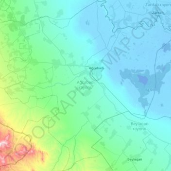
Name: Aghjabadi District topographic map, elevation, terrain.
Location: Aghjabadi District, Karabakh, Azerbaijan (39.73095 47.08860 40.25679 47.77779)
Average elevation: 79 m
Minimum elevation: -11 m
Maximum elevation: 709 m
Other topographic maps
Click on a map to view its topography, its elevation and its terrain.