
Barda topographic map
Interactive map
Click on the map to display elevation.
About this map
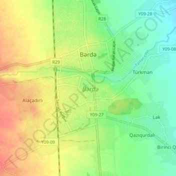
Name: Barda topographic map, elevation, terrain.
Location: Barda, Barda District, Karabakh, Azerbaijan (40.34450 47.11079 40.39767 47.14783)
Average elevation: 80 m
Minimum elevation: 56 m
Maximum elevation: 107 m
Other topographic maps
Click on a map to view its topography, its elevation and its terrain.
Khojavend District
Khojavend District, Karabakh, Azerbaijan
Average elevation: 951 m
Aghjabadi District
Aghjabadi District, Karabakh, Azerbaijan
Average elevation: 79 m