
Ağdam topographic map
Interactive map
Click on the map to display elevation.
About this map
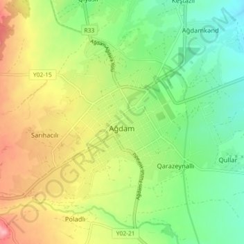
Name: Ağdam topographic map, elevation, terrain.
Location: Ağdam, Agdam District, Karabakh, Azerbaijan (39.97401 46.89501 40.00897 46.96612)
Average elevation: 370 m
Minimum elevation: 319 m
Maximum elevation: 441 m
Other topographic maps
Click on a map to view its topography, its elevation and its terrain.
Khojavend District
Khojavend District, Karabakh, Azerbaijan
Average elevation: 951 m
Aghjabadi District
Aghjabadi District, Karabakh, Azerbaijan
Average elevation: 79 m