Germany topographic maps
Click on a map to view its topography, its elevation and its terrain.
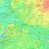
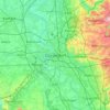
Berlin
Berlin straddles the banks of the River Spree, which flows into the River Havel (a tributary of the River Elbe) in the western borough of Spandau. Among the city's main topographical features are the many lakes in the western and southeastern boroughs formed by the Spree, Havel, and Dahme rivers (the largest…
Average elevation: 47 m
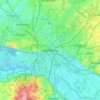
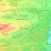
Hamburg
The neighborhoods of Neuenfelde, Cranz, Francop and Finkenwerder are part of the Altes Land (old land) region, the largest contiguous fruit-producing region in Central Europe. Neugraben-Fischbek has Hamburg's highest elevation, the Hasselbrack at 116.2 metres (381 ft) AMSL. Hamburg borders the states of…
Average elevation: 23 m
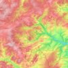
Brakel
Germany > North Rhine-Westphalia > Kreis Höxter
Brakel's Hanseatic roots go back to its early history and stretch through the Middle Ages. From the first written reference to "villa brechal" in 836 (in connection with transferring Saint Vitus's bones from Saint Denis, France, to Corvey) through to the 12th century, when it was the seat of the Lords of…
Average elevation: 232 m

Hamburg
The neighborhoods of Neuenfelde, Cranz, Francop and Finkenwerder are part of the Altes Land (old land) region, the largest contiguous fruit-producing region in Central Europe. Neugraben-Fischbek has Hamburg's highest elevation, the Hasselbrack at 116.2 metres (381 ft) AMSL. Hamburg borders the states of…
Average elevation: 56 m

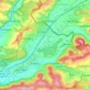
Stuttgart
Germany > Baden-Württemberg > Stuttgart
Stuttgart covers an area of 207.35 km2 (80 sq mi) and sits at elevation ranging from 207 m (679 ft) above sea level by the Neckar river to 549 m (1,801 ft) on Bernhartshöhe hill – something rather unique in large German cities. The most prominent elevated locales in Stuttgart are the Birkenkopf (511 m…
Average elevation: 353 m

Danger of ground subsidence!
Germany > Brandenburg > Dahme-Spreewald > Luckau > Fürstlich Drehna
Average elevation: 78 m


Mutlangen
Germany > Baden-Württemberg > Ostalbkreis
Mutlangen is located between the Welzheim Forest and the Swabian Keuper-Lias Plains on an elevation above the Rems valley. The neighboring communes of Mutlangen are Durlangen in the north, the city of Schwäbisch Gmünd in the east and south as well as Alfdorf in the west. Mutlangen consists of the small town…
Average elevation: 448 m
Bisingen
Germany > Baden-Württemberg > Zollernalbkreis
Bisingen is physically located along the northern edge of the Swabian Jura, between the Hundsrücken and the Hohenzollern mountains. Elevation above sea level in the municipal area ranges from a low of 485 meters (1,591 ft) Normalnull (NN) on the Klingenbach to a high of 912 meters (2,992 ft) NN at the top of…
Average elevation: 603 m




Filde
Germany > North Rhine-Westphalia > Oberbergischer Kreis > Radevormwald > Wönkhausen
Average elevation: 341 m







Grafenwoehr Training Area
Germany > Bavaria > Landkreis Neustadt an der Waldnaab > Grafenwöhr
Average elevation: 458 m





Bredenfelde
Germany > Mecklenburg-Vorpommern > Mecklenburgische Seenplatte > Woldegk
Average elevation: 109 m





Bochen
Germany > North Rhine-Westphalia > Oberbergischer Kreis > Wipperfürth > Neye
Average elevation: 299 m


Linderhof Palace
Germany > Bavaria > Landkreis Garmisch-Partenkirchen > Ettaler Forst
Average elevation: 1,109 m

Stuttgart
The core area of Stuttgart lies in the 48° fertile bowl angle about 900 ft (270 m) above sea level, an hour from the Black Forest and Swabian Jura on the banks of the Neckar river at 48°47′N 9°11′E / 48.783°N 9.183°E / 48.783; 9.183 115 mi (185 km) to the west and north of Munich. The city is…
Average elevation: 351 m


Herrenschwand
Germany > Baden-Württemberg > Landkreis Lörrach > Todtnau > Präg
Average elevation: 981 m

Paradies
Germany > Bavaria > Landkreis Lindau > Lindau (Bodensee) > Oberreitnau
Average elevation: 464 m