
Thank you for supporting this site ❤️
Make a donation
Make a donation
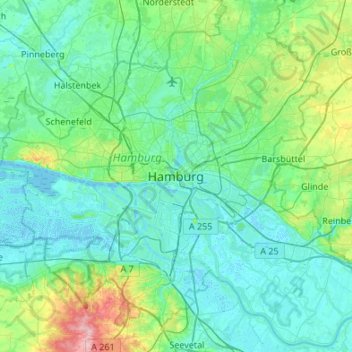
Hamburg topographic map
Click on the map to display elevation.
Thank you for supporting this site ❤️
Make a donation
Make a donation
Hamburg
The neighborhoods of Neuenfelde, Cranz, Francop and Finkenwerder are part of the Altes Land (old land) region, the largest contiguous fruit-producing region in Central Europe. Neugraben-Fischbek has Hamburg's highest elevation, the Hasselbrack at 116.2 metres (381 ft) AMSL. Hamburg borders the states of Schleswig-Holstein and Lower Saxony.
Thank you for supporting this site ❤️
Make a donation
Make a donation
About this map
Name: Hamburg topographic map, elevation, terrain.
Location: Hamburg, 20095, Germany (53.39034 9.84065 53.71034 10.16065)
Average elevation: 23 m
Minimum elevation: -3 m
Maximum elevation: 150 m
Thank you for supporting this site ❤️
Make a donation
Make a donation