
Sylhet Division topographic map
Interactive map
Click on the map to display elevation.
Sylhet Division
The region is considered one of the most picturesque and archaeologically rich regions in South Asia. It is home to three national parks; the Lawachara National Park, Khadim Nagar National Park and Satchari National Park, as well as numerous smaller parks and forests such as the Ratargul Swamp Forest, Rema-Kalenga Wildlife Sanctuary. Its burgeoning economy has contributed to the regional attractions of landscapes filled with fragrant orange and pineapple gardens as well as tea plantations. The region has a tropical monsoon climate (Köppen Am) bordering on a humid subtropical climate (Cwa) at higher elevations. The rainy season from April to October is hot and humid with very heavy showers and thunderstorms almost every day, whilst the short dry season from November to February is very warm and fairly clear. Nearly 80% of the annual average rainfall of 4,200 millimetres (170 in) occurs between May and September.
About this map
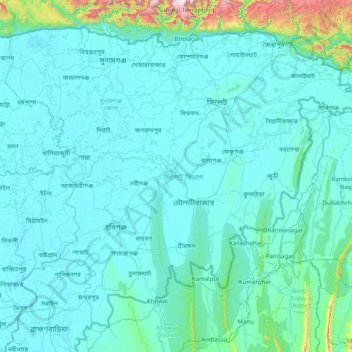
Name: Sylhet Division topographic map, elevation, terrain.
Location: Sylhet Division, Bangladesh (23.97438 90.91236 25.20735 92.49944)
Average elevation: 88 m
Minimum elevation: 0 m
Maximum elevation: 1,620 m
Other topographic maps
Click on a map to view its topography, its elevation and its terrain.
Rangamati
Bangladesh > Chattogram Division > Rangamati Sadar Upazila
Rangamati (Bengali: রাঙ্গামাটি is the administrative headquarter and town of Rangamati District in the Chittagong Hill Tracts of Bangladesh. The town is located at 22°37'60N 92°12'0E and has an altitude of 14 metres (46 ft). It was the capital of the Chakma kingdom during the British rule…
Average elevation: 68 m
Brahmaputra River
Bangladesh > Mymensingh Division > Jamalpur Sadar Upazila > Jamalpur
The course of the Brahmaputra River has changed drastically in the past two and a half centuries, moving its river course westwards for a distance of about 80 km (50 mi), leaving its old river course, appropriately named the old Brahmaputra river, behind. In the past, the floodplain of the old river course had…
Average elevation: 18 m
Cox's Bazar
Bangladesh > Chattogram Division
Cox's Bazar lies on a coastal plain in the southeastern corner of Bangladesh. From above, the plain appears to bulge out into the Bay of Bengal. Along the shore is an extensive area of beach and dunes. Most of the city is built on a floodplain that is lower in elevation than the dunes, making it more…
Average elevation: 8 m
Kurigram
Bangladesh > Rangpur Division > Kurigram Sadar Upazila
The town of Kurigram located in the alluvial plain of Teesta-Brahmaputra basin at the bank of Dharla River . The avarage elevation of the town in 31 meter. Kurigram's humid subtropical climate (Köppen Cwa) is influenced by the monsoon and features mild winters and extremely rainy and wet summers. The region…
Average elevation: 27 m
Khal from Moulovi bazar to Dowlatkhan
Bangladesh > Barisal Division > Doulatkhan Subdistrict
Average elevation: 5 m
Mollikpur( Hosenpur) village
Bangladesh > Sylhet Division > Mollikpur( Hosenpur) village
Average elevation: 6 m