
Bagh topographic map
Interactive map
Click on the map to display elevation.
About this map
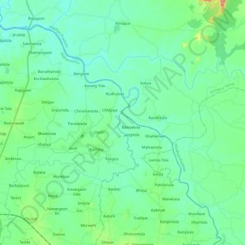
Name: Bagh topographic map, elevation, terrain.
Average elevation: 299 m
Minimum elevation: 271 m
Maximum elevation: 412 m
Other topographic maps
Click on a map to view its topography, its elevation and its terrain.
Bhopal
India > Madhya Pradesh > Huzur Tahsil
Bhopal has an average elevation of 500 metres (1401 ft) and is located in the central part of India, just north of the upper limit of the Vindhya mountain ranges. Located on the Malwa plateau, it is higher than the north Indian plains and the land rises towards the Vindhya Range to the south. The city has…
Average elevation: 498 m
Dewas
Due to its high elevation and inland location, even during the hottest months of the year, the nights are relatively cool, which is known as Shab-e-Malwa. Three distinct seasons are observed: summer, monsoon and winter. Dewas gets most of its rainfall during July–September due to the southwest monsoon.
Average elevation: 445 m
Indore
India > Madhya Pradesh > Juni Indore Tahsil
Indore /ɪnˈdɔːr/ (listen) is the most populous and the largest city in the Indian state of Madhya Pradesh. It serves as the headquarters of both Indore District and Indore Division. It is also considered as an education hub of the state and has campuses of both the Indian Institute of Technology and the…
Average elevation: 555 m
Khandwa
India > Madhya Pradesh > Khandwa Nagar Tahsil
Khandwa is located at 21°50′N 76°20′E / 21.83°N 76.33°E / 21.83; 76.33. It has an average elevation of 313 metres (1026 feet).
Average elevation: 325 m
Ujjain
India > Madhya Pradesh > Ujjain NagarTahsil
Ujjain is located in the west-central part of India, and is north of the upper limit of the Vindhya mountain ranges. Located on the Malwa plateau, it is higher than the north Indian plains and the land rises towards the Vindhya Range to the south. Ujjain's coordinates are 23°10′N 75°46′E /…
Average elevation: 501 m
Ashoknagar
Ashoknagar is situated at the average elevation of 507 metres(1640 ft) above sea level. It is in the plateau region. It has an agricultural topography. The plateau is an extension of the Deccan Traps, formed between 60 and 68 million years ago at the end of the Cretaceous period. In this region, the main…
Average elevation: 447 m
Morena
Morena is located at 26.5°N 78.0°E. It has an average elevation of 177 metres (580 feet). Its major rivers include the Chambal, Kwari, Asan, and Sank.
Average elevation: 226 m