
Make a donation
Bagh topographic map
Click on the map to display elevation.
Make a donation
About this map
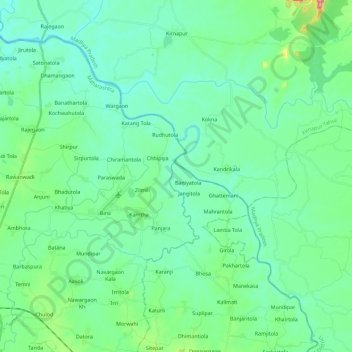
Name: Bagh topographic map, elevation, terrain.
Average elevation: 299 m
Minimum elevation: 271 m
Maximum elevation: 412 m
Make a donation
Other topographic maps
Click on a map to view its topography, its elevation and its terrain.
Narmadapuram
Pachmarhi is known for its natural environment, and lies at an altitude of 3,555 feet. It is surrounded by the Satpura hills. Satpura National Park and Madai Tiger Reserve are wildlife.
Average elevation: 458 m
Indore
India > Madhya Pradesh > Juni Indore Tahsil
Indore /ɪnˈdɔːr/ (listen) is the most populous and the largest city in the Indian state of Madhya Pradesh. It serves as the headquarters of both Indore District and Indore Division. It is also considered as an education hub of the state and has campuses of both the Indian Institute of Technology and the…
Average elevation: 555 m
Gwalior
India > Madhya Pradesh > Gird Tahsil
Gwalior is located at 26°13′N 78°11′E / 26.22°N 78.18°E / 26.22; 78.18. in northern Madhya Pradesh 300 km (186 miles) from Delhi. It has an average elevation of 197 metres (646 feet). Most part of it comes under the Bundelkhand area.
Average elevation: 235 m
Make a donation
Rajgarh
The Newaj is left bank tributary of the river Parwan which is a right bank principal tributary of the Kalisindh. The Newaj River rises at an elevation of 634 m in the Astha tehsil of the Sehore district in Madhya Pradesh and traverses a total length of 220 km, out of which 205 km is in Madhya Pradesh. The…
Average elevation: 429 m
Bhopal
India > Madhya Pradesh > Huzur Tahsil
Bhopal has an average elevation of 500 metres (1401 ft) and is located in the central part of India, just north of the upper limit of the Vindhya mountain ranges. Located on the Malwa plateau, it is higher than the north Indian plains and the land rises towards the Vindhya Range to the south. The city has…
Average elevation: 498 m
Make a donation
Make a donation
Ujjain
India > Madhya Pradesh > Ujjain NagarTahsil
Ujjain is located in the west-central part of India, and is north of the upper limit of the Vindhya mountain ranges. Located on the Malwa plateau, it is higher than the north Indian plains and the land rises towards the Vindhya Range to the south. Ujjain's coordinates are 23°10′N 75°46′E /…
Average elevation: 501 m
Make a donation
Make a donation
Make a donation
Manpur
India > Madhya Pradesh > Mhow Tahsil
Manpur is located at 22°26′N 75°37′E / 22.43°N 75.62°E / 22.43; 75.62. It has an average elevation of 567 metres (1860 feet).
Average elevation: 574 m
Make a donation
Make a donation
Make a donation
Make a donation
Make a donation
Make a donation
Make a donation
Make a donation
Make a donation
Make a donation
Make a donation
Make a donation
Make a donation
Khandwa
India > Madhya Pradesh > Khandwa Nagar Tahsil
Khandwa is located at 21°50′N 76°20′E / 21.83°N 76.33°E / 21.83; 76.33. It has an average elevation of 313 metres (1026 feet).
Average elevation: 325 m
Make a donation