
Ladakh Range topographic map
Interactive map
Click on the map to display elevation.
About this map
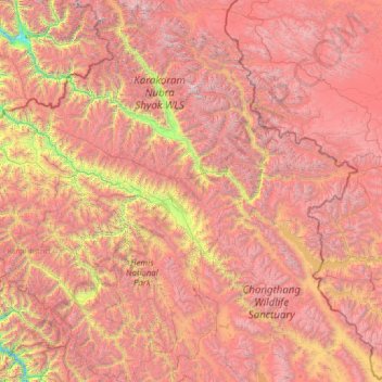
Name: Ladakh Range topographic map, elevation, terrain.
Location: Ladakh Range, Leh, Leh District, Jammu and Kashmir, India (33.13567 75.90539 35.24061 78.90750)
Average elevation: 4,936 m
Minimum elevation: 2,476 m
Maximum elevation: 7,445 m
Other topographic maps
Click on a map to view its topography, its elevation and its terrain.