
Pepinster topographic map
Interactive map
Click on the map to display elevation.
About this map
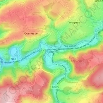
Name: Pepinster topographic map, elevation, terrain.
Location: Pepinster, Verviers, Liège, Wallonia, 4860, Belgium (50.54752 5.78371 50.58752 5.82371)
Average elevation: 220 m
Minimum elevation: 120 m
Maximum elevation: 322 m
Other topographic maps
Click on a map to view its topography, its elevation and its terrain.