
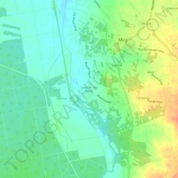
Casal de São Tomé topographic map
Interactive map
Click on the map to display elevation.
About this map
Name: Casal de São Tomé topographic map, elevation, terrain.
Location: Casal de São Tomé, Mira, Coimbra, 3070-081, Portugal (40.39736 -8.76722 40.43736 -8.72722)
Average elevation: 23 m
Minimum elevation: 6 m
Maximum elevation: 51 m
Other topographic maps
Click on a map to view its topography, its elevation and its terrain.