
Portomar topographic map
Interactive map
Click on the map to display elevation.
About this map
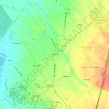
Name: Portomar topographic map, elevation, terrain.
Location: Portomar, Mira, Coimbra, 3070-352, Portugal (40.42357 -8.74823 40.46357 -8.70823)
Average elevation: 30 m
Minimum elevation: 6 m
Maximum elevation: 56 m
Other topographic maps
Click on a map to view its topography, its elevation and its terrain.
Casal de São Tomé
Casal de São Tomé, Mira, Coimbra, 3070-081, Portugal
Average elevation: 23 m
Cabeças Verdes
Portugal > Coimbra > Mira > Seixo
Cabeças Verdes, Seixo, Mira, Coimbra, 3070-352, Portugal
Average elevation: 30 m