
Thank you for supporting this site ❤️
Make a donation
Make a donation
Quincy topographic map
Click on the map to display elevation.
Thank you for supporting this site ❤️
Make a donation
Make a donation
About this map
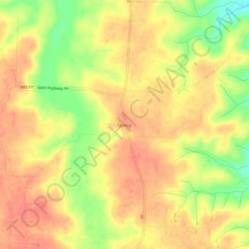
Name: Quincy topographic map, elevation, terrain.
Location: Quincy, Hickory County, Missouri, 65735, United States (37.98836 -93.49243 38.02836 -93.45243)
Average elevation: 290 m
Minimum elevation: 249 m
Maximum elevation: 312 m
Thank you for supporting this site ❤️
Make a donation
Make a donation
Other topographic maps
Click on a map to view its topography, its elevation and its terrain.