
Rohod topographic map
Interactive map
Click on the map to display elevation.
About this map
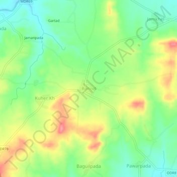
Name: Rohod topographic map, elevation, terrain.
Location: Rohod, Sakri, Dhule District, Maharashtra, India (21.02343 74.00815 21.06343 74.04815)
Average elevation: 641 m
Minimum elevation: 604 m
Maximum elevation: 692 m
Other topographic maps
Click on a map to view its topography, its elevation and its terrain.
Akkalpada
India > Maharashtra > Sakri
Akkalpada, Sakri, Dhule, Maharashtra, India
Average elevation: 381 m
Pratapur
India > Maharashtra > Sakri > Pratapur
Pratapur, Sakri, Dhule, Maharashtra, 424310, India
Average elevation: 527 m