
Pratapur topographic map
Interactive map
Click on the map to display elevation.
About this map
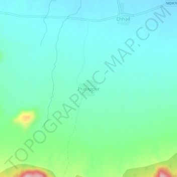
Name: Pratapur topographic map, elevation, terrain.
Location: Pratapur, Sakri, Dhule, Maharashtra, 424310, India (20.85982 74.24578 20.89982 74.28578)
Average elevation: 527 m
Minimum elevation: 482 m
Maximum elevation: 703 m