
Reva topographic map
Interactive map
Click on the map to display elevation.
About this map
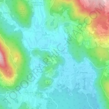
Name: Reva topographic map, elevation, terrain.
Location: Reva, Trebnje, 8211, Slovenië (45.84915 14.96217 45.88915 15.00217)
Average elevation: 304 m
Minimum elevation: 223 m
Maximum elevation: 549 m
Other topographic maps
Click on a map to view its topography, its elevation and its terrain.