
Pekel topographic map
Interactive map
Click on the map to display elevation.
About this map
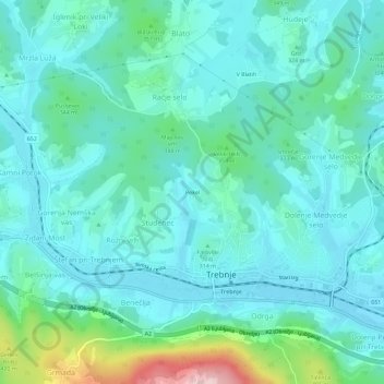
Name: Pekel topographic map, elevation, terrain.
Location: Pekel, Studenec, Trebnje, 8210, Slovenië (45.89638 14.98285 45.93638 15.02285)
Average elevation: 314 m
Minimum elevation: 264 m
Maximum elevation: 536 m