
Kallāpārai topographic map
Interactive map
Click on the map to display elevation.
About this map
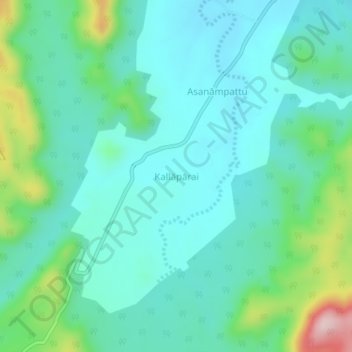
Name: Kallāpārai topographic map, elevation, terrain.
Location: Kallāpārai, Vellore, Vellore District, Tamil Nadu, India (12.67473 78.78688 12.71473 78.82688)
Average elevation: 449 m
Minimum elevation: 382 m
Maximum elevation: 689 m
Other topographic maps
Click on a map to view its topography, its elevation and its terrain.
Vellore
India > Tamil Nadu > Vellore
Vellore, Vellore District, Tamil Nadu, 632012, India
Average elevation: 283 m
Vallam
India > Tamil Nadu > Vellore
Vallam, Vellore, Vellore District, Tamil Nadu, 632319, India
Average elevation: 203 m