
Thank you for supporting this site ❤️
Make a donation
Make a donation
Vallam topographic map
Click on the map to display elevation.
Thank you for supporting this site ❤️
Make a donation
Make a donation
About this map
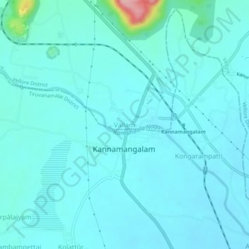
Name: Vallam topographic map, elevation, terrain.
Location: Vallam, Vellore, Vellore District, Tamil Nadu, 632319, India (12.73373 79.13195 12.77373 79.17195)
Average elevation: 203 m
Minimum elevation: 184 m
Maximum elevation: 360 m
Thank you for supporting this site ❤️
Make a donation
Make a donation