
Thank you for supporting this site ❤️
Make a donation
Make a donation
Franklin County topographic map
Click on the map to display elevation.
Thank you for supporting this site ❤️
Make a donation
Make a donation
About this map
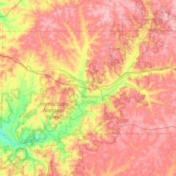
Name: Franklin County topographic map, elevation, terrain.
Location: Franklin County, Mississippi, United States (31.32012 -91.15744 31.61144 -90.63279)
Average elevation: 102 m
Minimum elevation: 25 m
Maximum elevation: 161 m
Thank you for supporting this site ❤️
Make a donation
Make a donation
Other topographic maps
Click on a map to view its topography, its elevation and its terrain.
Shady Groove Park And Baseball Field
United States > Mississippi > George County > Central
Average elevation: 60 m