
Maasmechelen topographic map
Interactive map
Click on the map to display elevation.
About this map
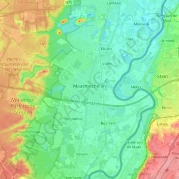
Name: Maasmechelen topographic map, elevation, terrain.
Location: Maasmechelen, Tongern, Limburg, Belgien (50.91037 5.59532 51.01227 5.76767)
Average elevation: 57 m
Minimum elevation: 28 m
Maximum elevation: 119 m
Other topographic maps
Click on a map to view its topography, its elevation and its terrain.