
Tongern topographic map
Interactive map
Click on the map to display elevation.
About this map
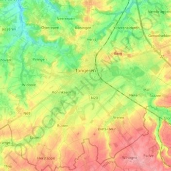
Name: Tongern topographic map, elevation, terrain.
Location: Tongern, Limburg, Flandern, 3700, Belgien (50.72015 5.38897 50.82236 5.55295)
Average elevation: 101 m
Minimum elevation: 54 m
Maximum elevation: 154 m
Other topographic maps
Click on a map to view its topography, its elevation and its terrain.