
Thank you for supporting this site ❤️
Make a donation
Make a donation
Hilda topographic map
Click on the map to display elevation.
Thank you for supporting this site ❤️
Make a donation
Make a donation
About this map
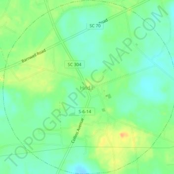
Name: Hilda topographic map, elevation, terrain.
Location: Hilda, Barnwell County, South Carolina, 29813, United States (33.25959 -81.26376 33.28844 -81.22936)
Average elevation: 78 m
Minimum elevation: 65 m
Maximum elevation: 96 m
Thank you for supporting this site ❤️
Make a donation
Make a donation
Other topographic maps
Click on a map to view its topography, its elevation and its terrain.
Barnwell State Park
United States > South Carolina > Barnwell County > Blackville
Average elevation: 84 m
Thank you for supporting this site ❤️
Make a donation
Make a donation