
Thank you for supporting this site ❤️
Make a donation
Make a donation
Barnwell State Park topographic map
Click on the map to display elevation.
Thank you for supporting this site ❤️
Make a donation
Make a donation
About this map
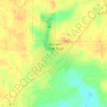
Name: Barnwell State Park topographic map, elevation, terrain.
Average elevation: 83 m
Minimum elevation: 61 m
Maximum elevation: 95 m
Thank you for supporting this site ❤️
Make a donation
Make a donation
Other topographic maps
Click on a map to view its topography, its elevation and its terrain.
Barnwell State Park
United States > South Carolina > Barnwell County > Blackville
Average elevation: 84 m
Thank you for supporting this site ❤️
Make a donation
Make a donation