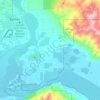
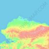
Nome Census Area topographic map
Click on the map to display elevation.
About this map

Name: Nome Census Area topographic map, elevation, terrain.
Location: Nome Census Area, Alaska, United States (64.30311 -163.79302 65.70311 -162.39302)
Average elevation: 167 m
Minimum elevation: -1 m
Maximum elevation: 1,051 m
Other topographic maps
Click on a map to view its topography, its elevation and its terrain.

Umnak Island
United States > Alaska > Unorganized Borough
Umnak, the third largest of the Aleutian Islands after Unimak and Unalaska, lies in the Fox Islands of the Aleutian Islands of the Bering Sea, to the southwest of the larger island of Unalaska. It is approximately 70–72 miles (113–116 km) in length (117 kilometres (73 mi)) and 16 miles (26 km) wide on…
Average elevation: 64 m

Kenai Fjords National Park
The park's landscape has been shaped by plate tectonics, with the Pacific Plate subducting beneath the North American Plate. The process has lowered the elevation of the Kenai Mountains, gradually pulling glacial features down into the sea, which is at the same time rising. The floors of the fjords can be from…
Average elevation: 518 m

Unalaska Island
Unalaska is the second-largest island in the Fox Islands group and the Aleutian Islands. The coastline of Unalaska is markedly different in appearance than other major Aleutian Islands, with numerous inlets and peninsulas. The irregular coastline is broken by three long deep bays, Beaver Inlet, Unalaska Bay,…
Average elevation: 74 m


Katmai National Park
The foundation rocks on the Alaska Peninsula are divided by the Bruin Bay Fault into fossiliferous sedimentary rocks of Jurassic and Cretaceous age to the east and metamorphic and igneous rocks to the west. The granite Aleutian Range batholith has intruded through these rocks. The majority of the higher…
Average elevation: 245 m


Kobuk Valley National Park
According to the Köppen climate classification system, Kobuk Valley National Park has a Subarctic climate (Dfc) with cool summers and year around precipitation. Dfc climates are defined by their coldest month averaging below 0 °C (32 °F) , 1–3 months averaging above 10 °C (50 °F), all months with…
Average elevation: 331 m
Lake Clark National Park
The park is not accessible by roads. Access is solely by air taxi or by boat along the Cook Inlet coast and Lake Clark. Since much of the movement in the area is by air, the mountains present a significant barrier to air traffic. Lake Clark Pass, at 1,050 feet (320 m) provides a way through the mountains by…
Average elevation: 671 m
Willow
Willow has a subarctic climate with long and cold winters and mild summers. Whites Crossing is a weather station near Willow, situated at an elevation of 270 ft (82 m).
Average elevation: 208 m



Adak
United States > Alaska > Unorganized Borough
Because of its naval aviation past, Adak has an unusually large and sophisticated airport for the Aleutian Islands. The airport is currently operated by the State of Alaska Department of Transportation. Complete with an Instrument Landing System, Adak Airport has no control tower and two 200 ft (61 m) wide…
Average elevation: 134 m


Glacier Bay
United States > Alaska > Unorganized Borough
Glacier Bay is covered with 1,375 square miles (3,560 km2) of glaciers which accounts for 27% of the Park area with most glaciers originating in mountains with elevation range of 8,000–15,000 feet (2,400–4,600 m). There are over 50 named glaciers (both tidewater and terrestrial glaciers); 10 tide water…
Average elevation: 402 m




Skagway
United States > Alaska > Skagway > Liarsville Gold Rush Trail Camp & Salmon Bake
Average elevation: 551 m