
Gamsen topographic map
Interactive map
Click on the map to display elevation.
About this map
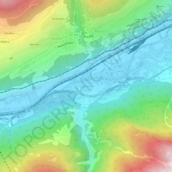
Name: Gamsen topographic map, elevation, terrain.
Location: Gamsen, Brig-Glis, Brig, Wallis, 3903, Schweiz (46.28418 7.93116 46.32418 7.97116)
Average elevation: 1,084 m
Minimum elevation: 650 m
Maximum elevation: 2,111 m
Other topographic maps
Click on a map to view its topography, its elevation and its terrain.