
Brig-Glis topographic map
Interactive map
Click on the map to display elevation.
About this map
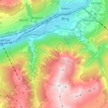
Name: Brig-Glis topographic map, elevation, terrain.
Location: Brig-Glis, Brig, Wallis, Schweiz (46.25467 7.91018 46.32295 8.03117)
Average elevation: 1,526 m
Minimum elevation: 650 m
Maximum elevation: 2,726 m
Other topographic maps
Click on a map to view its topography, its elevation and its terrain.