
Wasagaming topographic map
Interactive map
Click on the map to display elevation.
About this map
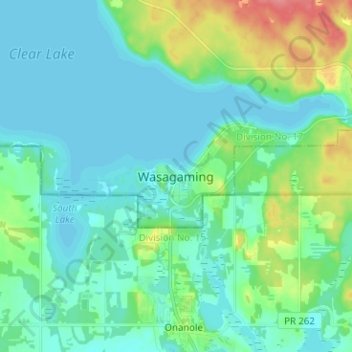
Name: Wasagaming topographic map, elevation, terrain.
Location: Wasagaming, Manitoba, R0J 1N0, Canada (50.61784 -100.01188 50.69784 -99.93188)
Average elevation: 630 m
Minimum elevation: 615 m
Maximum elevation: 683 m