
Krakatau topographic map
Interactive map
Click on the map to display elevation.
About this map
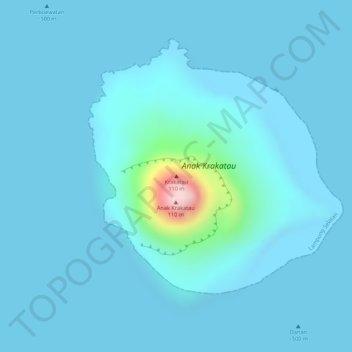
Name: Krakatau topographic map, elevation, terrain.
Location: Krakatau, Lampung, Indonésie (-6.10017 105.42282 -6.10007 105.42292)
Average elevation: 20 m
Minimum elevation: 0 m
Maximum elevation: 278 m
Other topographic maps
Click on a map to view its topography, its elevation and its terrain.