
Tanggamus topographic map
Interactive map
Click on the map to display elevation.
About this map
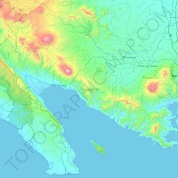
Name: Tanggamus topographic map, elevation, terrain.
Location: Tanggamus, Lampung, Sumatra, Indonésie (-5.93710 104.31237 -5.09095 105.19616)
Average elevation: 246 m
Minimum elevation: -1 m
Maximum elevation: 2,053 m
Other topographic maps
Click on a map to view its topography, its elevation and its terrain.