
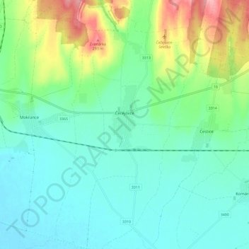
Čečejovce topographic map
Interactive map
Click on the map to display elevation.
About this map
Name: Čečejovce topographic map, elevation, terrain.
Average elevation: 217 m
Minimum elevation: 186 m
Maximum elevation: 303 m
The village lies at an altitude of 205 metres and covers an area of 24.527 km2. The village is located 22 kilometres from Košice.
Other topographic maps
Click on a map to view its topography, its elevation and its terrain.
Kechnec
Slovakia > Region of Košice > District of Košice - okolie
Kechnec, District of Košice - okolie, Region of Košice, Eastern Slovakia, Slovakia
Average elevation: 188 m