
Thank you for supporting this site ❤️
Make a donation
Make a donation
Oğuz topographic map
Click on the map to display elevation.
Thank you for supporting this site ❤️
Make a donation
Make a donation
About this map
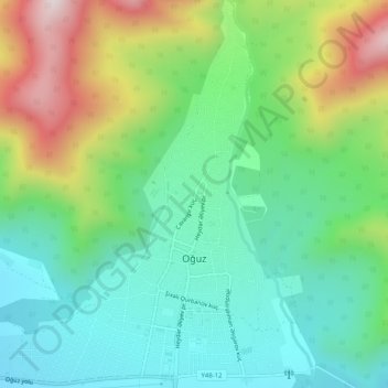
Name: Oğuz topographic map, elevation, terrain.
Location: Oğuz, Oghuz District, Sheki-Zaqatala, Azerbaijan (41.05486 47.43571 41.09306 47.47880)
Average elevation: 748 m
Minimum elevation: 512 m
Maximum elevation: 1,242 m
Thank you for supporting this site ❤️
Make a donation
Make a donation
Other topographic maps
Click on a map to view its topography, its elevation and its terrain.