
Thank you for supporting this site ❤️
Make a donation
Make a donation
Qabala District topographic map
Click on the map to display elevation.
Thank you for supporting this site ❤️
Make a donation
Make a donation
About this map
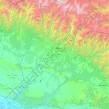
Name: Qabala District topographic map, elevation, terrain.
Location: Qabala District, Sheki-Zaqatala, Azerbaijan (40.66608 47.54532 41.22191 48.07408)
Average elevation: 1,179 m
Minimum elevation: 34 m
Maximum elevation: 4,432 m
Thank you for supporting this site ❤️
Make a donation
Make a donation
Other topographic maps
Click on a map to view its topography, its elevation and its terrain.