
Thank you for supporting this site ❤️
Make a donation
Make a donation
Shaw topographic map
Click on the map to display elevation.
Thank you for supporting this site ❤️
Make a donation
Make a donation
About this map
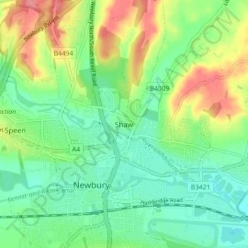
Name: Shaw topographic map, elevation, terrain.
Location: Shaw, West Berkshire, England, RG14 2DF, United Kingdom (51.39178 -1.33580 51.43178 -1.29580)
Average elevation: 93 m
Minimum elevation: 64 m
Maximum elevation: 143 m
Thank you for supporting this site ❤️
Make a donation
Make a donation
Other topographic maps
Click on a map to view its topography, its elevation and its terrain.
Thank you for supporting this site ❤️
Make a donation
Make a donation
Thank you for supporting this site ❤️
Make a donation
Make a donation