
Thank you for supporting this site ❤️
Make a donation
Make a donation
Great Shefford topographic map
Click on the map to display elevation.
Thank you for supporting this site ❤️
Make a donation
Make a donation
About this map
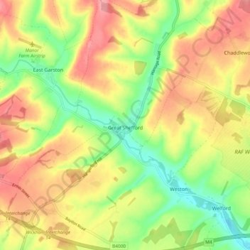
Name: Great Shefford topographic map, elevation, terrain.
Location: Great Shefford, West Berkshire, England, United Kingdom (51.44746 -1.49043 51.50569 -1.42143)
Average elevation: 148 m
Minimum elevation: 93 m
Maximum elevation: 201 m
Thank you for supporting this site ❤️
Make a donation
Make a donation
Other topographic maps
Click on a map to view its topography, its elevation and its terrain.