
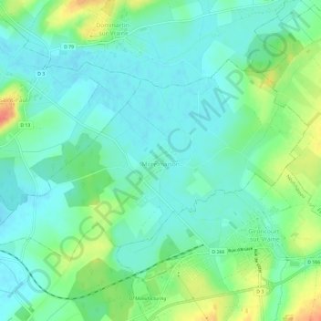
Morelmaison topographic map
Interactive map
Click on the map to display elevation.
About this map
Name: Morelmaison topographic map, elevation, terrain.
Average elevation: 321 m
Minimum elevation: 306 m
Maximum elevation: 357 m
Other topographic maps
Click on a map to view its topography, its elevation and its terrain.
Rue du Mont
France > Grand Est > Vosges > Chamagne
Rue du Mont, Chamagne, Épinal, Vosges, Grand Est, France métropolitaine, 88130, France
Average elevation: 268 m
Neufchâteau
Neufchâteau, Vosges, Grand Est, France métropolitaine, 88300, France
Average elevation: 334 m
Saint-Dié-des-Vosges
France > Grand Est > Vosges > Saint-Dié-des-Vosges
Saint-Dié-des-Vosges, Vosges, Grand Est, France métropolitaine, 88100, France
Average elevation: 433 m