
Thank you for supporting this site ❤️
Make a donation
Make a donation
Pursat topographic map
Click on the map to display elevation.
Thank you for supporting this site ❤️
Make a donation
Make a donation
About this map
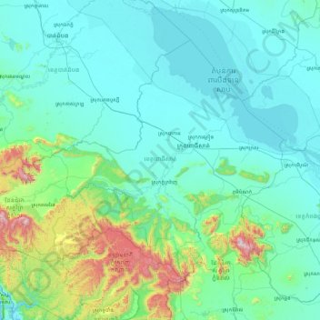
Name: Pursat topographic map, elevation, terrain.
Location: Pursat, Cambodia (11.84326 102.70351 13.08914 104.39515)
Average elevation: 187 m
Minimum elevation: -3 m
Maximum elevation: 1,769 m
Thank you for supporting this site ❤️
Make a donation
Make a donation
Other topographic maps
Click on a map to view its topography, its elevation and its terrain.