
Waterfront Mahebourg topographic map
Interactive map
Click on the map to display elevation.
About this map
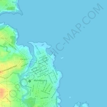
Name: Waterfront Mahebourg topographic map, elevation, terrain.
Average elevation: 5 m
Minimum elevation: 0 m
Maximum elevation: 38 m
Other topographic maps
Click on a map to view its topography, its elevation and its terrain.
Mahébourg
Mauritius > Grand Port > Mahébourg
Mahébourg, Grand Port, 50812, Mauritius
Average elevation: 30 m