
Taney County topographic map
Interactive map
Click on the map to display elevation.
About this map
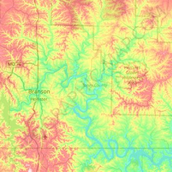
Name: Taney County topographic map, elevation, terrain.
Location: Taney County, Missouri, United States (36.49783 -93.31534 36.81680 -92.76499)
Average elevation: 304 m
Minimum elevation: 188 m
Maximum elevation: 497 m
Other topographic maps
Click on a map to view its topography, its elevation and its terrain.
Downtown Kansas City
United States > Missouri > Jackson County > Downtown Kansas City
Average elevation: 271 m