
Suhl topographic map
Interactive map
Click on the map to display elevation.
About this map
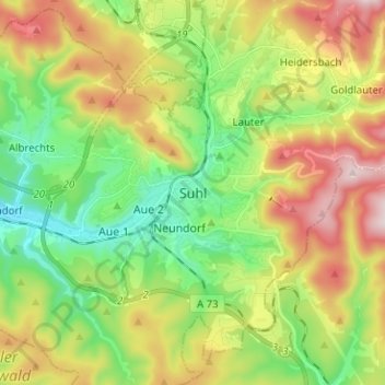
Name: Suhl topographic map, elevation, terrain.
Location: Suhl, Thüringen, 98527, Duitsland (50.56865 10.65264 50.64865 10.73264)
Average elevation: 565 m
Minimum elevation: 382 m
Maximum elevation: 841 m
Other topographic maps
Click on a map to view its topography, its elevation and its terrain.