
Suhl topographic map
Interactive map
Click on the map to display elevation.
About this map
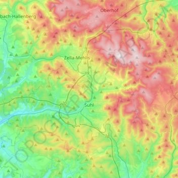
Name: Suhl topographic map, elevation, terrain.
Location: Suhl, Thüringen, Duitsland (50.56075 10.55215 50.68895 10.84262)
Average elevation: 602 m
Minimum elevation: 342 m
Maximum elevation: 979 m
Other topographic maps
Click on a map to view its topography, its elevation and its terrain.