
Xiongguan District topographic map
Interactive map
Click on the map to display elevation.
About this map
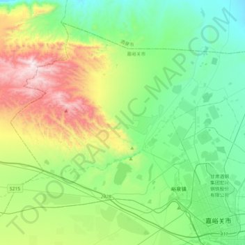
Name: Xiongguan District topographic map, elevation, terrain.
Location: Xiongguan District, Jiayuguan, Gansu, 735100, China (39.76889 97.98356 39.99469 98.34204)
Average elevation: 1,805 m
Minimum elevation: 1,430 m
Maximum elevation: 2,764 m
Other topographic maps
Click on a map to view its topography, its elevation and its terrain.