
Thank you for supporting this site ❤️
Make a donation
Make a donation
Stjær topographic map
Click on the map to display elevation.
Thank you for supporting this site ❤️
Make a donation
Make a donation
About this map
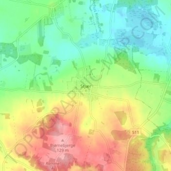
Name: Stjær topographic map, elevation, terrain.
Location: Stjær, Skanderborg Kommune, Jutland central, 8464, Danemark (56.09864 9.93409 56.13864 9.97409)
Average elevation: 59 m
Minimum elevation: 10 m
Maximum elevation: 129 m
Thank you for supporting this site ❤️
Make a donation
Make a donation
Other topographic maps
Click on a map to view its topography, its elevation and its terrain.