
Virelles topographic map
Interactive map
Click on the map to display elevation.
About this map
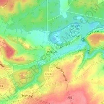
Name: Virelles topographic map, elevation, terrain.
Location: Virelles, Chimay, Thuin, Hennegau, Wallonien, 6461, Belgien (50.04480 4.31298 50.08480 4.35298)
Average elevation: 228 m
Minimum elevation: 194 m
Maximum elevation: 268 m
Other topographic maps
Click on a map to view its topography, its elevation and its terrain.