
Chimay topographic map
Interactive map
Click on the map to display elevation.
About this map
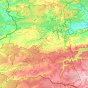
Name: Chimay topographic map, elevation, terrain.
Location: Chimay, Thuin, Hennegau, Wallonien, Belgien (49.94174 4.19667 50.12994 4.44609)
Average elevation: 263 m
Minimum elevation: 162 m
Maximum elevation: 374 m
Other topographic maps
Click on a map to view its topography, its elevation and its terrain.