
Thank you for supporting this site ❤️
Make a donation
Make a donation
Sheldon topographic map
Click on the map to display elevation.
Thank you for supporting this site ❤️
Make a donation
Make a donation
About this map
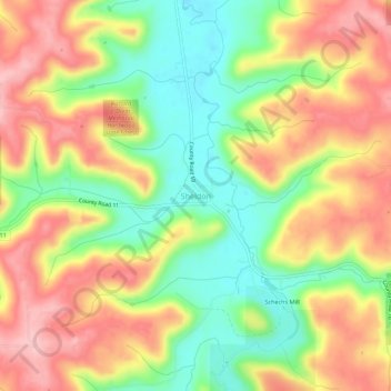
Name: Sheldon topographic map, elevation, terrain.
Location: Sheldon, Houston County, Minnesota, United States (43.65830 -91.61320 43.69830 -91.57320)
Average elevation: 298 m
Minimum elevation: 215 m
Maximum elevation: 380 m
Thank you for supporting this site ❤️
Make a donation
Make a donation
Other topographic maps
Click on a map to view its topography, its elevation and its terrain.