
Make a donation
Gonggar County topographic map
Click on the map to display elevation.
Make a donation
Gonggar County
Gonggar County is located in southern Tibet and has a total area of 2,283 square kilometres (881 sq mi). The Yarlung Tsangpo River (Brahmaputra River), the mother river of Tibet, flows through the Gonggar County and among other counties of Shannan, and is thus rich in water resources. Set in west to east direction, the county is a plateau land with an average altitude of 3,750 metres (12,300 ft). The Gonggar County is situated at a location where Yarlung Tsangpo River is very wide. It is for this reason that the Gonggar Airport was constructed at this location. The airport lies to the west of Rawa-me, which is the capital of the county at the entry of the Namrab Valley, 96 kilometres (60 mi) from Lhasa and 87 kilometres (54 mi) from Tsetang, the capital of Shannan. The county is bounded by the Mount Chuwaru (held sacred in Tibet) opposite to Chusul, the Gompa La (4,794 kilometres (2,979 mi)) Pass to the south on the route to the sacred Yamdrok Lake in West Tibet, on the east to the limits of the Dal Valley on the south bank of the Brahmaputra and Dorje Monastery on the north bank. The county also envelops the southern side valleys of Namrab and Drib counties and the northern side valleys of Leuchung and Trango counties.
Make a donation
About this map
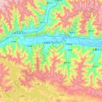
Name: Gonggar County topographic map, elevation, terrain.
Location: Gonggar County, Lhoka, Tibet, China (28.93898 90.46995 29.52896 91.23763)
Average elevation: 4,378 m
Minimum elevation: 3,555 m
Maximum elevation: 5,748 m
Make a donation
Other topographic maps
Click on a map to view its topography, its elevation and its terrain.
Mount Everest
China > Tibet > Tingri County
Mount Everest (Nepali: सगरमाथा, romanized: Sagarmāthā; Tibetan: Chomolungma ཇོ་མོ་གླང་མ; Chinese: 珠穆朗玛峰; pinyin: Zhūmùlǎngmǎ Fēng) is Earth's highest mountain above sea level, located in the Mahalangur Himal sub-range of the Himalayas. The China–Nepal…
Average elevation: 7,851 m
Make a donation
Lhoka
China > Tibet > Tsetang Township
Shannan has 1 district and 11 counties and its capital is Tsetang, which is located 183 kilometres from Lhasa. It covers an area of 79,700 square kilometres (30,800 sq mi), which includes part of South Tibet, a disputed territory currently under control of the Indian state of Arunachal Pradesh. Its topography…
Average elevation: 4,148 m
Nagqu
Nagqu is located in the northeast of Tibet. Nagqu Town is 330 kilometres (210 mi) by the China National Highway 109 northeast of Lhasa. Nagqu is bordered by Bayingolin and Hotan Prefectures of Xinjiang to the north, Haixi, Yushu Prefectures of Qinghai and Chamdo to the east, Nyingchi, Lhasa and Shigatse to the…
Average elevation: 4,624 m
Lhamo Latso
China > Tibet > Gyatsa County > Cuijiu
Lhamo Latso... [is] a brilliant azure jewel set in a ring of grey mountains. The elevation and the surrounding peaks combine to give it a highly changeable climate, and the continuous passage of cloud and wind creates a constantly moving pattern on the surface of the waters. On that surface visions appear to…
Average elevation: 5,104 m