
Creuzburg topographic map
Interactive map
Click on the map to display elevation.
About this map
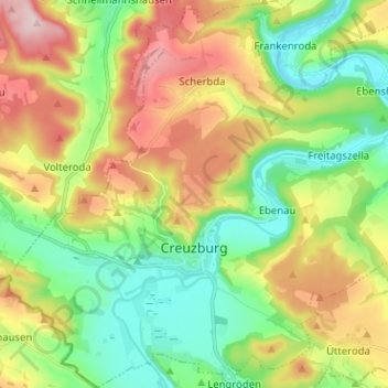
Name: Creuzburg topographic map, elevation, terrain.
Average elevation: 295 m
Minimum elevation: 177 m
Maximum elevation: 481 m
Other topographic maps
Click on a map to view its topography, its elevation and its terrain.
Hörschel
Duitsland > Thüringen > Wartburgkreis > Eisenach
Hörschel, Eisenach, Wartburgkreis, Thüringen, 99819, Duitsland
Average elevation: 254 m
Heldrastein
Duitsland > Thüringen > Wartburgkreis > Treffurt
Heldrastein, Treffurt, Wartburgkreis, Thüringen, 99830, Duitsland
Average elevation: 352 m
Eisenach
Duitsland > Thüringen > Wartburgkreis
Eisenach, Wartburgkreis, Thüringen, 99817, Duitsland
Average elevation: 298 m