
Thank you for supporting this site ❤️
Make a donation
Make a donation
McBride topographic map
Click on the map to display elevation.
Thank you for supporting this site ❤️
Make a donation
Make a donation
About this map
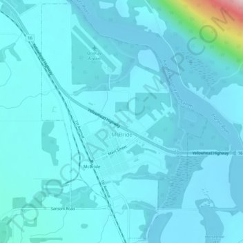
Name: McBride topographic map, elevation, terrain.
Average elevation: 727 m
Minimum elevation: 700 m
Maximum elevation: 1,026 m
Thank you for supporting this site ❤️
Make a donation
Make a donation
Other topographic maps
Click on a map to view its topography, its elevation and its terrain.
Prince George
Canada > British Columbia > Regional District of Fraser-Fort George > Prince George
Average elevation: 708 m