
Thank you for supporting this site ❤️
Make a donation
Make a donation
Kilcreggan topographic map
Click on the map to display elevation.
Thank you for supporting this site ❤️
Make a donation
Make a donation
About this map
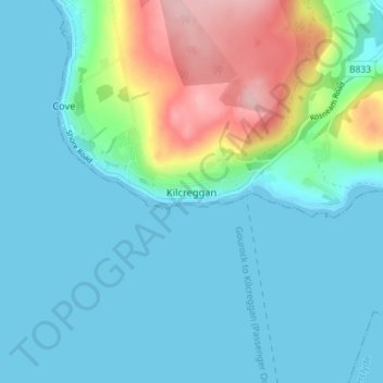
Name: Kilcreggan topographic map, elevation, terrain.
Location: Kilcreggan, Argyll and Bute, Scotland, G84 0JZ, United Kingdom (55.96463 -4.84995 56.00463 -4.80995)
Average elevation: 34 m
Minimum elevation: 0 m
Maximum elevation: 161 m
Thank you for supporting this site ❤️
Make a donation
Make a donation